What Is a Geofence? A Practical Guide to Geofence Alerts
Learn how geofences and enter or exit alerts work, with practical examples and tips for drawing an area that produces useful notifications.
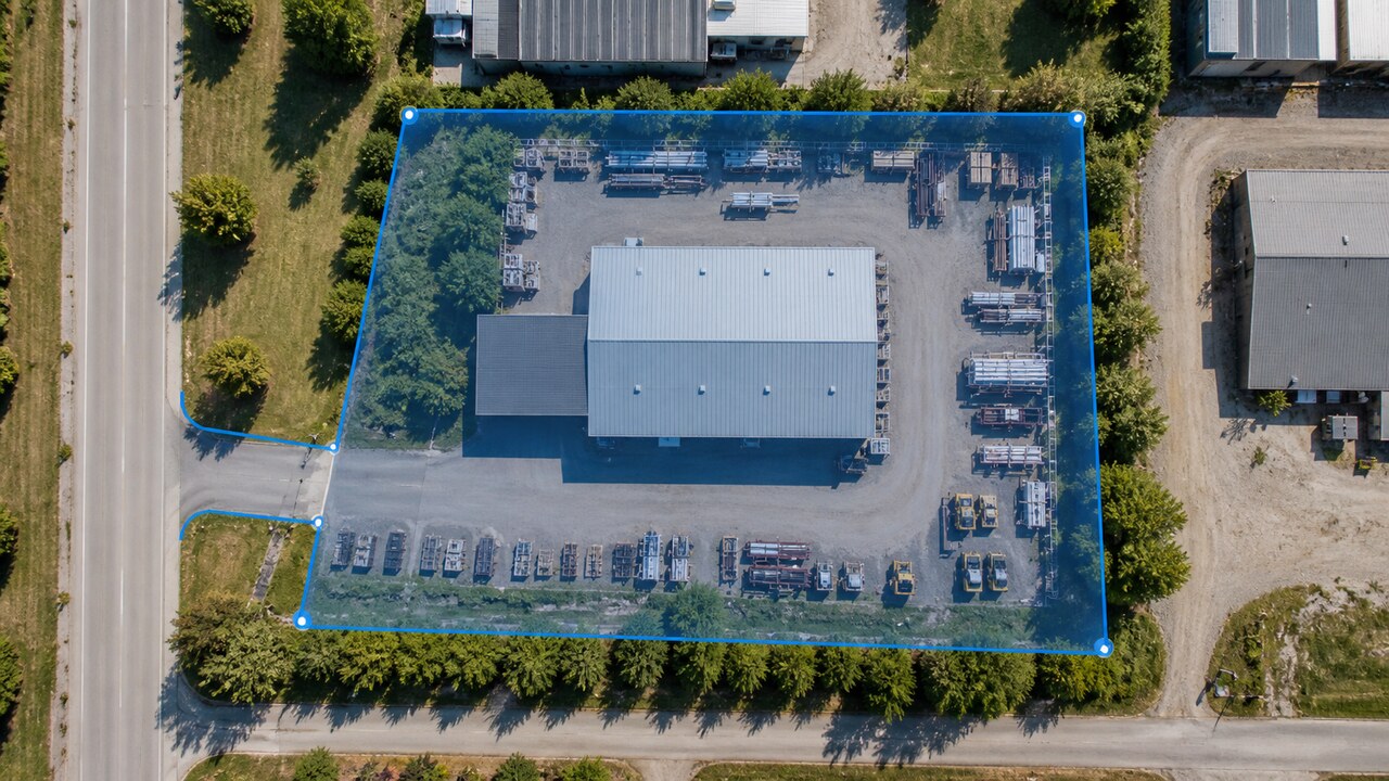
A geofence is a virtual area drawn on a map. When a GPS tracker reports a position on one side of that area and its next position is on the other, the tracking platform can record that the tracker entered or left the geofence.
Think of it as a useful map-based trigger, not a physical fence or a continuous tripwire. It helps you notice arrivals and departures without watching the map all day.
Enter and exit alerts do different jobs
An enter alert tells you when a tracker moves from outside the geofence to inside it. An exit alert tells you when it moves from inside to outside.
ShieldGPS lets you turn these options on or off separately. Both are enabled by default when you create a new geofence, so review the settings before saving. You might want both for a customer site, only an exit alert for a storage yard, or only an enter alert when you care about a vehicle returning to a workplace.
The alert names the tracker and geofence involved. Delivery depends on the notification methods enabled for your account. Push and email settings should be checked in the dashboard. SMS alerts also require the tracker that generated the alert to have a current plan with SMS allowance, plus account SMS notifications, a verified phone number, and remaining monthly quota.
Useful places for a geofence
Start with a place where an arrival or departure would change what you do next:
- Home: Notice when a tracked vehicle leaves or returns to the area around your driveway.
- Workplace: Use arrivals and departures as a prompt to check the latest location and timestamp.
- Storage yard: Learn when equipment or a vehicle crosses the yard area, especially outside its normal routine.
- Customer site: See when a tracker arrives at or leaves a location relevant to a job.
Use names that will make sense in a notification, such as “North Yard” or “Main Workshop.” “Tracker 2 left the North Yard geofence” is much easier to understand quickly than an alert containing an unclear place name.
How ShieldGPS applies a geofence
A saved ShieldGPS geofence currently applies to every tracker on the same account. The current editor does not support assigning a geofence to selected trackers only.
If assigning geofences to selected trackers would help your setup, let us know.
That account-wide behavior matters when choosing locations. If several trackers regularly pass the same customer site but only one is relevant to that job, the geofence may create alerts for the others too. In that situation, consider whether the location is useful enough for the whole account before saving it.
Draw an area that matches the real routine
In the ShieldGPS map, open the geofence editor and tap at least three points to make a polygon. A simple shape is usually easier to manage than a tight outline with many corners.
Give the geofence some breathing room. GPS positions naturally vary, especially near buildings, trees, or other obstructions. If you draw directly along a building wall, property line, or parking space, small changes in reported position can look like repeated crossings.
It helps to:
- Include the normal parking or storage area, not only the object’s exact resting spot.
- Place the edge beyond the usual GPS variation around that location.
- Include the driveway or access point if you want the crossing to happen after a clear departure.
- Keep the edge away from nearby roads that your trackers use without visiting the site.
- Test the geofence during an ordinary arrival and departure, then adjust it if the alert happens too early, too late, or too often.
Understand the timing limits
ShieldGPS detects a crossing by comparing consecutive recorded positions. It needs an earlier position to establish whether the tracker was inside or outside, so the first position alone cannot produce an enter or exit event.
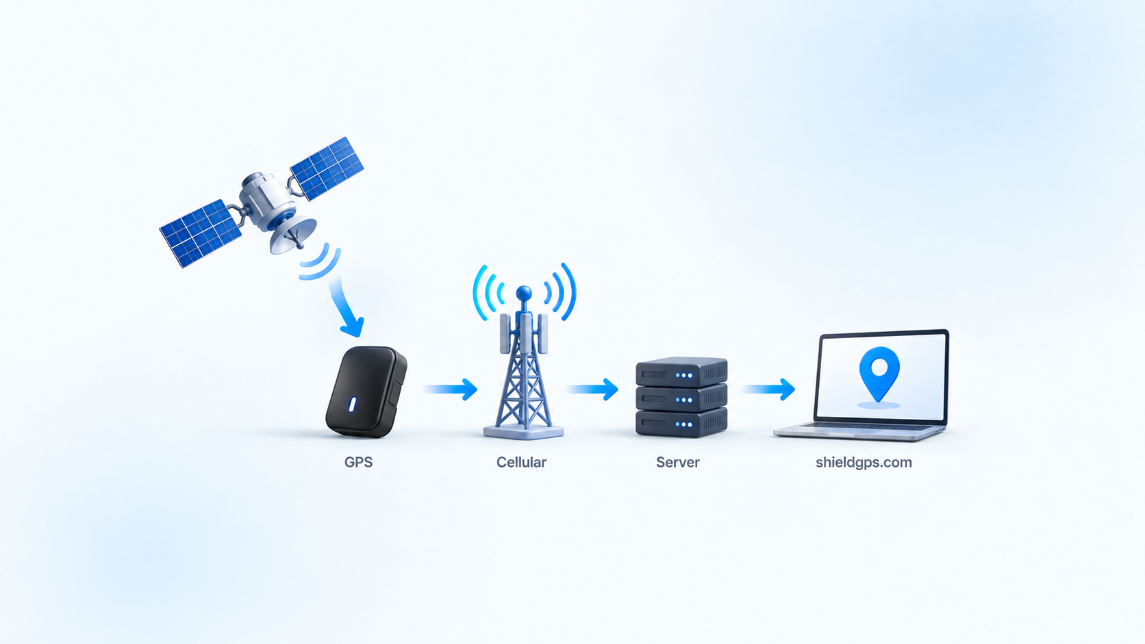
Geofence alerts also depend on the tracker obtaining and sending usable positions. A reporting delay can delay the alert. A very small area can be passed between updates, leaving both recorded positions outside it. This is another reason to draw a practical area rather than the smallest possible outline.
When an alert arrives, check the reported location and timestamp for context. Our guide to what GPS tracking can and cannot tell you explains how reporting intervals, connectivity, and satellite visibility affect the positions you see.